
| HRLPC Home | Distance | Maintained By | Parking | Trail Walk | Canoe/Kayak |
|---|---|---|---|---|---|
| Trail Restrictions | Blaze Markings | Trail Benches | Doug Smith Island | Trail Photos |
Maintained by: The Hockanum River Linear Park Committee (HRLPC)
Parking at the beginning of the trail:
The most accessible trailhead for this path is on the right side of the Kohl's parking lot at 155 Tolland Turnpike.
The green and white sign on the road reading "Hockanum River Hiking Trail" is the first clue. The brown sign, "TRAIL" with
a "No Bikes" symbol, marks the hiker entrance.
The trail walk:
(Note that the HRLPC favors locating the trail as close to the river as possible when laying out and clearing trails.)
This is a 2.0 mile loop trail, in a green belt along the north side of the river close to I-84, and with a return
along the south side of the river. The trail runs behind multiple businesses on the south side of the river behind
Tolland Turnpike.
50 feet from the trailhead, the path divides. Straight ahead are 5 steps down to a 30 foot bridge with
wood railings, across the river to a 4 acre Doug Smith Island in the river with its 0.4 mile loop trail through
a very scenic meadow and forest. Deer hang out here frequently.
Back off the island, the main Oakland loop goes either up or downstream. Upstream, the path goes down 8 steps and
across a 20 foot bridge through a small meadow, then behind Conyers garages, and over another footbridge. It then proceeds
around a chain-link fence, down a slope, through a meadow-and-forest area, behind various industrial and auto dealer sites
seen off (through the woods) to the side, and eventually out to the Motel 6 vehicle bridge.
The trail turns left over the bridge, then left again now downstream, over a Boy Scout footbridge and along grass,
enters the woods and proceeds past Motel 6. The path follows close to the river still downstream, through meadow
and forest, with the river on the left and I-84 close to the right behind trees. Try to ignore the traffic noise and focus
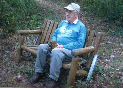
on the scenic beauty of the river, the water birds, the bench for a brief relaxation, and the wildflowers.
At ¾ miles downstream the path goes under I-84 entrance and exit ramp bridges, over several mini-footbridges, up a
steep flight of steps, through a meadow and numerous white pines planted as seedlings in 1983. It then goes left across
the river on our big steel footbridge.
(Historically, this large footbridge was constructed in Minnesota and installed here in April, 2006, to
replace an old bridge erected by the Connecticut State DOT in 1951.) This bridge is also part of the
In the diagram below, click on the "Boat Launch" icon ![]() to jump to
the Town of Manchester's "Canoe & Kayak Access Guide" page, for information on this launch site.
to jump to
the Town of Manchester's "Canoe & Kayak Access Guide" page, for information on this launch site.
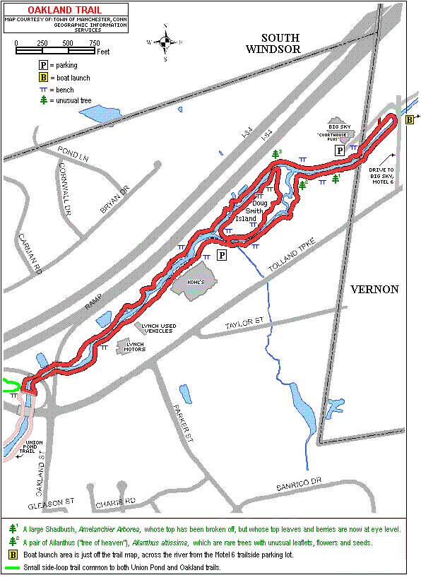
The trail next turns right on the other end of the bridge, and then sharply right again, and finally upstream under
the big footbridge.
The trail then follows up along the river, under the highway exit and entrance bridges again. It next goes down a bank
and across a brook via stepping stones. Take caution here. Now it comes out behind Lynch Motors into a beautifully
landscaped woodland strip, with steps up to the Toyota dealership (where weary hikers can find rest rooms and benches).
The path follows the river in a low floodplain meadow, on a woodchip course behind Lynch Used Vehicles, up a slope and
along the rear of Kohl's store back to the starting point.
Flora seen on the Oakland Trail include red maple, cottonwood, alder, phragmities, Japanese knotweed, black cherry,
buttonbush, goldenrod, jewelweed, purple loosestrife, multiflora roses, viburnum, Queen Anne's lace, wild cucumber, trout
lily, common blue violet, poison ivy and watercress.
Fauna seen here include white tail deer, mallard ducks, Canada geese, kingfishers, great blue herons, river otters,
beavers, muskrats and woodchucks.
Canoe/Kayak:
Details on the boat launch icon can be found on the Town of Manchester web site's
Historical Information:
The name of the trail comes from the northern section of the Town of Manchester in which it's located. The
history of Oakland is described in several articles in the website of the Manchester Historical Society, one of
which can be accessed by clicking
here.
"Doug Smith Island" Dedication
On June 2, 2018, Bryan Island was formally renamed Doug Smith Island during a ceremony on the Island, nearest
the entrance to the Trail at the northeast end of Kohl's parking lot.
To see a slideshow of pictures taken during this ceremony, as well as related articles and a facsimile of the
proclamation itself, please click here.
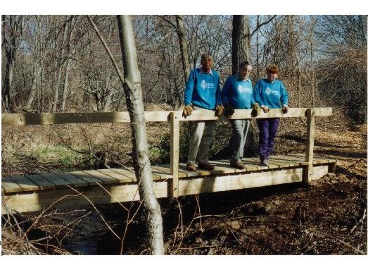
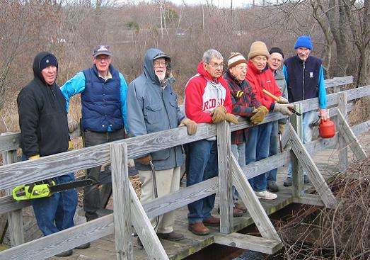
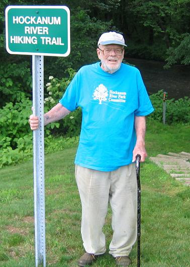
Trail Photos:
|
|
|
|
|---|