
| HRLPC Home | Distance | Maintained By | Parking | Trail Walk | Historical Info |
|---|---|---|---|---|---|
| Trail Restrictions | Blaze Markings | Trail Benches | Trail Photos |
Maintained by: The Hockanum River Linear Park Committee (HRLPC)
Parking at the beginning of the trail:
Parking is on the right, just inside the softball field entrance driveway, off the east side of New State Road.
The trail walk:
(Note that the HRLPC favors locating the trail as close to the river as possible when laying out and clearing
trails.)
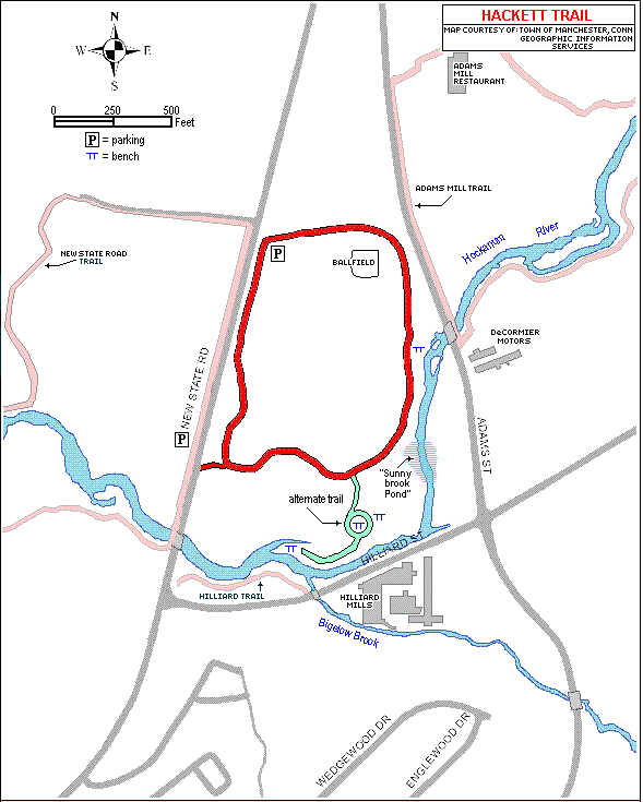
The hiking trail is a 0.75 mile loop trail on a 20-acre parcel of Town of Manchester-owned land. It is relatively
flat former farm land, with mature hardwood forest and flood plain, partially abutting the Hockanum River. This easy loop
is a very relaxing scenic path for leisurely walking, jogging, cross-country skiing and snow shoeing.
Parking and trailhead are on the right, just inside the softball field entrance driveway; and the trail goes south
through the meadow and emerging forest along New State Road. Lining both sides of this first section of path are numerous
White Pines and emerging new pine seedlings, to buffer the wilderness hiking experience from adjacent traffic.
Soon the path enters mature forest, still going south and gradually bearing to the left, past our solitary American
Holly tree on the left; and continuing past the Sunnybrook Village Apartments off through the woods on the right. The
trail twists and turns in beautiful forest, and then comes to a junction. The right fork goes around as a short loop in
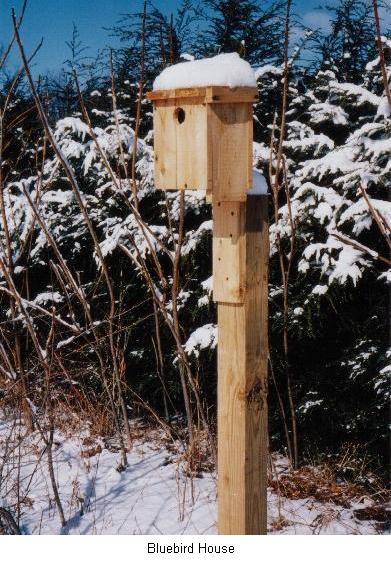
the southern end of the property revealing two nice benches, one for a brief pause and view of a Wood Duck box (which
sometimes will shelter a Screech Owl in winter, when the usual residents are south for the winter); and further south a
second bench and a patch of grass facing the Hockanum and Hilliard Street and a view of the Hilliard Mill across the Street.
The left fork main trail curves around now towards the east and north past several vernal pools, and then views of the
Hockanum and Adams Street beyond. Then another bench appears on the river bank for watching the passing mallards and perhaps
kayakers in season. The trail next opens out onto the Softball Field grass and parking lot and then, close to Adams Street,
there is a path that leads hikers seeking the Adams Mill Trail ahead on the right across
Adams Street.
For hikers heading back to the trailhead next to New State Road, the path follows the grass around the outside of the
parking lot along the north side of the property and back to the starting point.
Wild flowers are not abundant along this trail due to deep woodland cover; but deer are around to eat acorns or the
lush green meadow grass. Occasional meadow birds may be spotted and, along the river, a solitary Great Blue Heron or Belted
Kingfisher may be seen.
Historical Information:
This tract of land was owned by the John H. Hackett family for many years; and tobacco was grown, harvested and stored
to dry in a large shed there during the early and mid 1900s. In more recent years, corn was raised on the 10 acres of open
land. Then the Town purchased the entire property with its woodland and river frontage in 2001. The New State Road
Softball Field was completed here in 2003, leaving a large surrounding tract of meadow and forest intact, with the hiking
trail around the periphery.
Trail Photos: